|
|||||||||||
| District RHEIN-PFALZ-KREIS - Church Register - |
|||||||||||
|
|
|
||||||||||
| District RHEIN-PFALZ-KREIS on the map of Germany (Source: Wikipedia) |
District RHEIN-PFALZ-KREIS on the map of Rhineland-Palatinate (Source: Wikipedia) |
|||||||||||
|
||||||||||||
|
||||||||||||
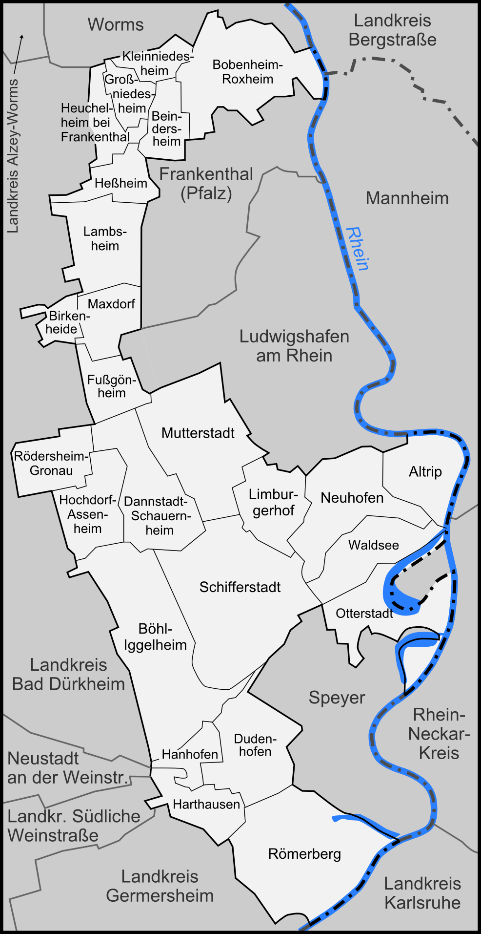
| Locations in the District RHEIN-PFALZ-KREIS (Source: Wikipedia) |
||||||||||||


| The following Municipal Register contains all places of the "Geschichtlichen Orts-Verzeichnisses" (GOV) of CompGen in RHEIN-PFALZ-KREIS. By activating the individual buttons in the four columns >Topo<, >SLUB<, >GOV< and >Meyers<, the geographical location of a place can be called up on a map from the geographical OpenTopoMap and Kartenforum or the place descriptions in the GOV-Ortsverzeichnis and Meyers Gazetteer. | ||||||||||||||||||||||||||
| A | B | C | D | E | F | G | H | I | J | K | L | M | N | O | P | Q | R | S | T | U | V | W | X | Y | Z | |
| Community | District | Location Type | GOV | Meyers | Parts of a Community | Type | Coordinates | Topo | WikiM | SLUB | GOV |
| Bobenheim-Roxheim | Rhein-Pfalz-Kreis | Community |  |
 |
Roxheim-Bobenheim | Municipality | |
||||
| B�hl-Iggelheim | Rhein-Pfalz-Kreis | Community | |
|
Iggelheim | Municipality | |
||||
| B�hl | Municipality | |
St. Simon und Juda | Municipality | 49.3620 N 008.3099 E |  |
 |
 |
|
Allerheiligen | Municipality | 49.3861 N 008.2939 E | |
|
|
|
| Community | District | Location Type | GOV | Meyers | Parts of a Community | Type | Coordinates | Topo | WikiM | SLUB | GOV |
| Lambsheim | Rhein-Pfalz-Kreis | Community | |
|
Lambsheim | Municipality | 49.5121 N 008.2867 E | |
|
|
|
| St. Stephanus | Municipality | 49.5119 N 008.2877 E | |
|
|
|
|||||
| Limburgerhof | Rhein-Pfalz-Kreis | Community | |
|
St. Bonifatius | Municipality | 49.4208 N 008.3905 E | |
|
|
|
| Limburgerhof | Municipality | |
|||||||||
| Community | District | Location Type | GOV | Meyers | Parts of a Community | Type | Coordinates | Topo | WikiM | SLUB | GOV |
| Mutterstadt | Rhein-Pfalz-Kreis | Community | |
|
St. Medardus | Municipality | 49.4397 N 008.3593 E | |
|
|
|
| Mutterstadt | Municipality | |
|||||||||
| Community | District | Location Type | GOV | Meyers | Parts of a Community | Type | Coordinates | Topo | WikiM | SLUB | GOV |
| R�merberg | Rhein-Pfalz-Kreis | Community | |
|
St. Pankratius | Municipality | 49.2937 N 008.4105 E | |
|
|
|
| Community | District | Location Type | GOV | Meyers | Parts of a Community | Type | Coordinates | Topo | WikiM | SLUB | GOV |
| Schifferstadt | Rhein-Pfalz-Kreis | Town | |
|
St. Laurentius | City | 49.3773 N 008.3778 E | |
|
|
|
| Schifferstadt (Herz Jesu) | City | 49.3825 N 008.3883 E | |
|
|
|
Schifferstadt | City | |
St. Jakobus | City | 49.3870 N 008.3716 E | |
|
|
|
|
||||||||||